Good thing National Weather Service employees are considered “essential” and won’t be furloughed during the government shutdown. Aircraft reconnaissance now shows that a tropical disturbance in the southern Gulf of Mexico has intensified into a tropical storm, which is expected to continue to strengthen into Hurricane Karen.
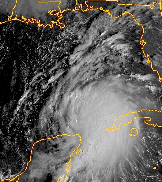
Satellite image of Tropical Storm Karen in the Yucatan Channel. (NASA)
Tropical storm and hurricane watches are now in effect for a section of northern Gulf coast from New Orleans to Biloxi Mississippi, Mobile Alabama, Panama City and Pensacola Florida. Tropical storm conditions are expected to begin showing up in all of these areas as soon as late Friday afternoon.
Maximum sustained winds are now up to 60 mph. The intensity forecast over the next three days will be important to watch as it heads for the Gulf Coast.
The National Hurricane Center and most models are now converging on a landfall on Saturday near Mobile, plus or minus 125 miles or so, as a strong tropical storm.
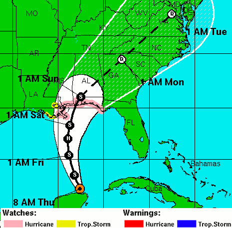
NHC forecast track, cone of uncertainty, and watches/warnings as of 9am EDT. (NOAA)
A long stretch of heavy rain is expected along Karen’s track over the next several days, with 6-8 inches possible from eastern Louisiana over to the western Florida panhandle, and several inches from Florida all the way up the East Coast to Maine. Rain associated with Karen could reach the D.C. area during the day on Monday.
© 2013, Glynn Wilson. All rights reserved.